TYPE: Group Work
COLLABORATOR: Chenyu Xu, Ruilan Jia
TUTOR: Prof. Violet
LOCATION: New York, NY, USA
DATE: Fall 2017
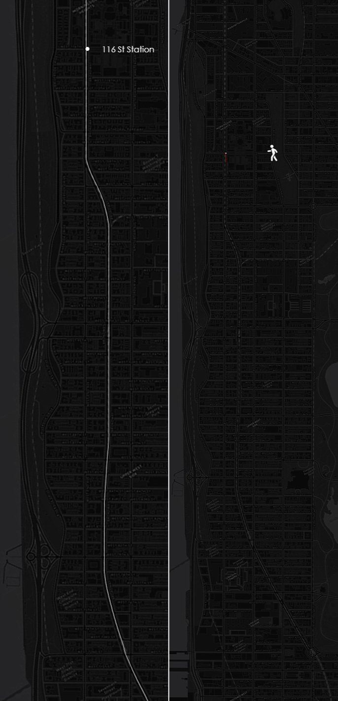
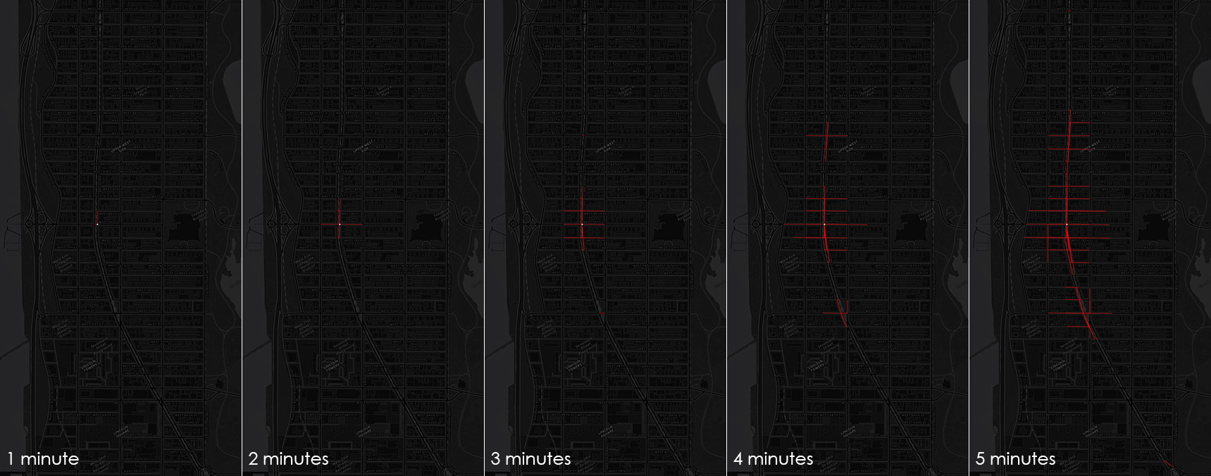
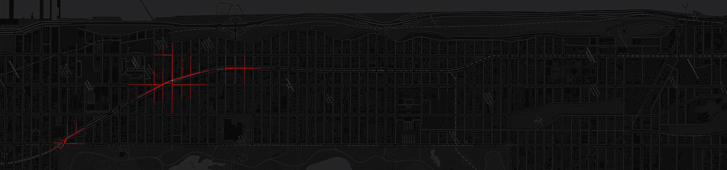
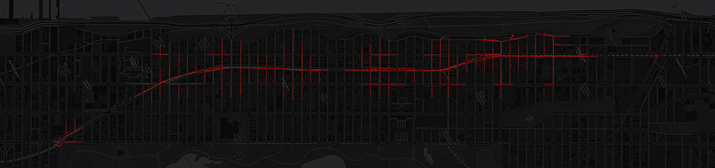
When we are in a spot with which we are not familiar, it’s always good to know that how long it is going to take us to get to our destination. Our aim is to visualize the distance that we can reach within 5 minutes by walking as well as by train, taking spots on Broadway, NYC, as example. Our project could be used as a basis for selecting any type of amenity, such as restaurant, bus stop, etc., within a reaching distance, by overlapping their locations. With the same logic, we will be able to develop other means of transportation including bicycle, bus, etc.
Data sources: Google Maps Directions API, NYC Open Data
Tools: Python in Processing, Adobe Photoshop, Adobe After Effects